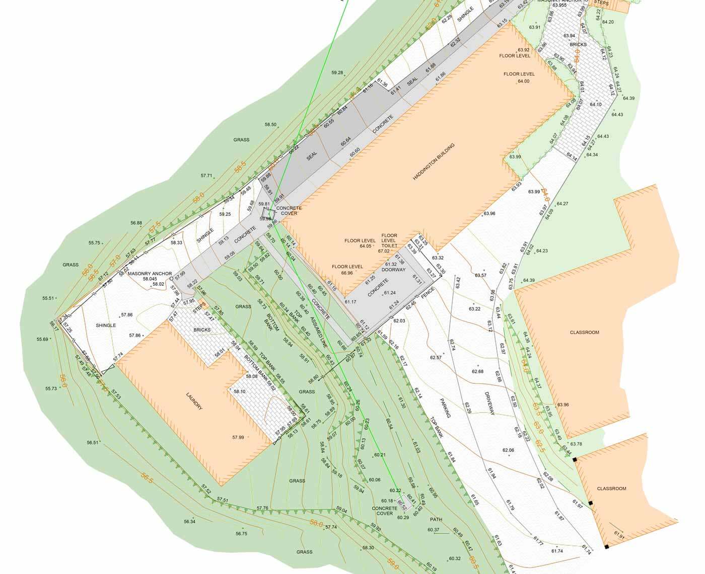
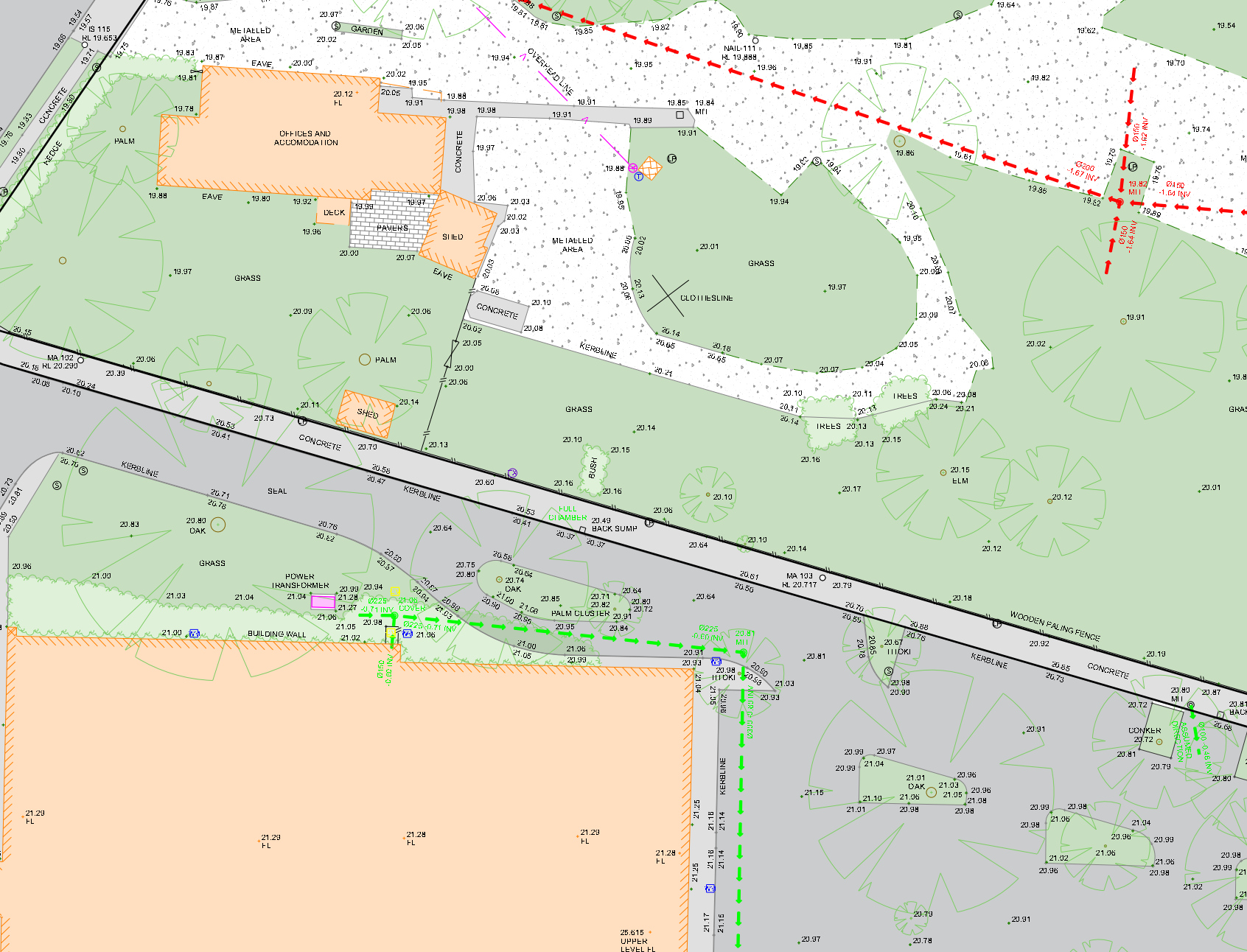
Site Survey Plans Topographical plans (also known as site survey plans) are drawn from digital field survey data to show positions and levels of physical features, and sometimes overlaid onto a Scheme Plan to enhance detail. Used by Architects, Engineers & Planners. Enquire Now Δ CommentsThis field is for validation purposes and should be left unchanged.Name(Required)Email(Required) Phone(Required)Enquiry(Required)Please include the property address if applicable