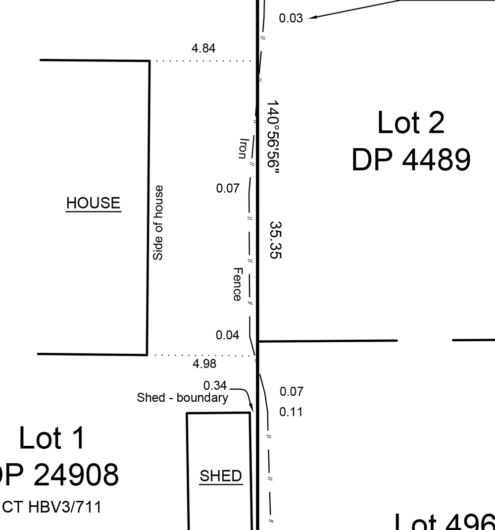
Boundary occupation plans are drawn from field survey data to show positions of physical features such as fences, block walls or trees etc near a boundary. This can also include the surveyors calculated offsets to the true position of the boundary.
Among other things, they are sometimes used by property owners in neighbour disputes.